Input A is a Major City (e.g., Manhattan, Shanghai, Dubai, Paris). Analyze the location to generate 2 Cartographic Assets: The Epicenter (The Pole): Identify the densest cluster of skyscrapers or the central landmark. (e.g., Manhattan -> Empire State/One World Trade. Dubai -> Burj Khalifa. Paris -> Eiffel Tower). The Sprawl (The Texture): Identify the surrounding urban fabric. (e.g., Grid streets, River bends, Desert roads). Container Goal: “Tiny Planet“ 360 Drone Photography. The Geometry: The world is warped into a perfect Sphere (Stereographic Projection) floating in the center of the frame. The Perspective: Nadir (Straight Down). The camera looks directly down at the “Epicenter.“ Topography The Center: The “Epicenter“ (Step 1) sits in the exact center of the image. Effect: Because of the projection, the central buildings point straight up at the camera, while the surrounding buildings fan out radially. Radial Expansion: The “Sprawl“ (Step 1) radiates outwards from the center, wrapping around the curvature of the sphere. Distortion: Skyscrapers at the edge of the sphere appear to point outwards horizontally into space. Visual Sky: A ring of blue sky and wispy clouds surrounds the entire planet, framing the urban density. Shadow: The sphere casts no shadow on the background; it is floating in the upper atmosphere. Lighting & Atmosphere: Lighting: High Noon Sun. Bright, even illumination. The sun creates strong contrast between the rooftops and the street canyons. Detail: High-resolution drone photography aesthetic. Crisp, sharp details. Output: ONE image, 1:1 Aspect Ratio, Photorealistic 360 Render, “Little Prince“ aesthetic, High Distortion.
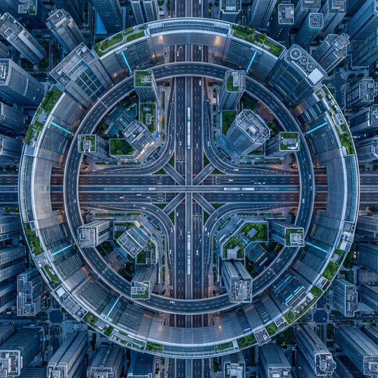
INPUT_PATTERN: Top-down view of a Phillips Head Screw (A perfect metal circle with a cross indentation).
PAREIDOLIA_FILTER: "Utopian Intersection."
<interpretation_logic>
The Cross (+) -> Render a 12-lane futuristic highway intersection (4-way stop).
The Metal Circle Head -> A circular wall or ring-road encompassing the city center.
The Brushed Steel Texture -> Silver skyscrapers and brutalist architecture.
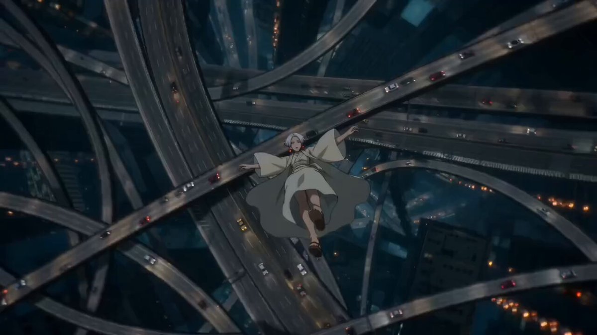
A surreal cinematic aerial shot of a futuristic мегacity at night, filled with towering skyscrapers and multi-level looping highways twisting in impossible geometry. Streams of car headlights and taillights form glowing ribbons of motion.
A serene anime-style woman wearing flowing white robes (kimono-inspired) floats and falls gracefully through the air between the looping highways. Her sleeves and fabric billow in slow motion, giving an ethereal, weightless feel.
The camera tracks her descent from above, rotating and drifting as she passes through spiraling overpasses and interwoven roads. Traffic moves naturally below, light trails streaking through the dark blue city atmosphere.
The environment feels dreamlike and gravity-defying, with massive curved flyovers forming elegant arcs in space. Subtle fog and atmospheric haze add depth and scale.
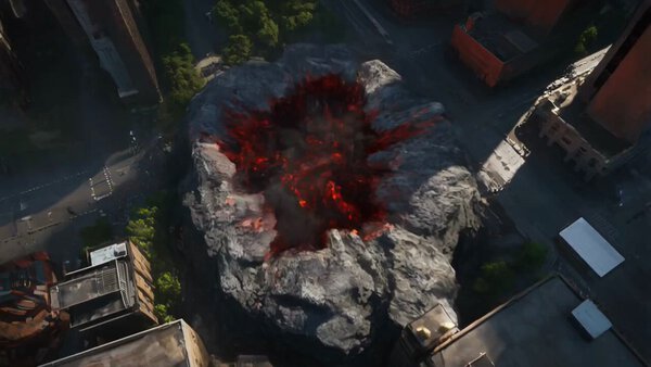
A horned demon titan with magma skin and burning wings erupts from a fiery crater in the city center, unleashing a ring of fire that expands through streets. The camera begins with a top-down drone view, then nose-dives directly toward the crater as the demon ascends in a pillar of smoke and flame
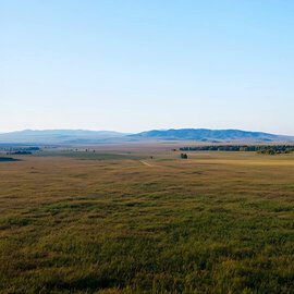
“Time-lapse of a futuristic city evolving from empty land into towering skyscrapers over decades. Seasons rapidly changing, people and vehicles speeding by. Smooth day-to-night transitions. Final wide pull-back reveal at night with glowing city lights. Cinematic, inspirational style, dynamic motion, uplifting mood.”
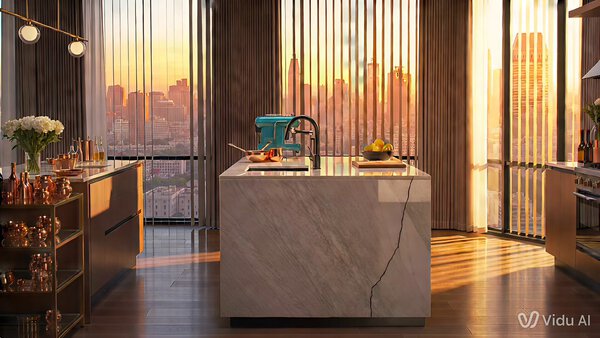
location: luxury penthouse kitchen, one continuous mini story
Modern luxury penthouse kitchen at golden hour, warm sunlight through floor to ceiling windows, city skyline outside, marble island, copper cookware, a distinctive teal espresso machine, a small crack on the right edge of the marble, a bowl of lemons near the sink. Same main character throughout: a woman chef in a white linen shirt with rolled sleeves and a thin red bracelet on her left wrist. Keep her appearance, outfit, props, lighting, and kitchen layout consistent across every cut.
CUT TO: Wide establishing shot showing the full kitchen layout, skyline, marble island center frame, teal espresso machine on the back counter, lemons by the sink.
CUT TO: Medium shot from the same side of the island as she places a wooden cutting board on the marble, the crack still visible near the right edge.
CUT TO: Close-up on her hands, red bracelet visible, slicing a strawberry tart topping; crumbs and fruit glisten in the same warm light.
CUT TO: Over-shoulder shot as she plates the tart on a matte black plate, teal espresso machine softly blurred in the background.
CUT TO: Insert close-up of espresso pouring from the teal machine into a small cup, crema forming, same golden reflections on the metal.
CUT TO: Medium shot as she carries the plate and cup to the window-side counter; skyline stays in the same direction, sunlight consistent.
CUT TO: Tight close-up as she smiles and adjusts a lemon slice garnish; end on the tart’s glossy surface with the skyline bokeh behind it.
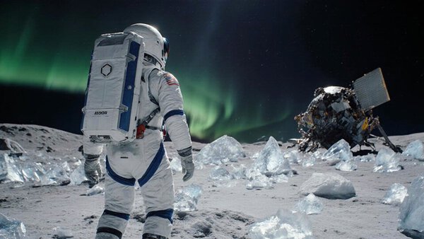
Wide-angle landscape shot, an explorer in an advanced EVA suit treks across the frozen surface of an alien moon, ice shards glint like glass, distant terrain shows a crashed satellite half-consumed by ice, soft green auroras dance across the sky — a lonely, beautiful moment of sci-fi isolation.
 Kling 2.6