Paris Surreal Trefoil City

日付
モデル
ソース

プロンプトをコピー

Do this for Paris: <instruction>
1.  Inference Engine 
Input A is a Major Global City (e.g., Paris, New York, Venice, Tokyo, Dubai).
Deconstruct the city to generate   3 Cartographic Assets  :
   The Anchor (The Landmark):  Identify the single most iconic, recognizable vertical structure.
       (e.g., Paris -> The Eiffel Tower. NYC -> The Empire State Building. Dubai -> Burj Khalifa). 
   The Fabric (The Architecture):  Identify the dominant building style, roof types, and color palette of the dense urban areas.
       (e.g., Paris -> Beige Haussmann blocks with grey slate roofs. Venice -> Terracotta and peeling stucco. Tokyo -> Dense glass, concrete, and neon). 
   The Artery (The Flow):  Identify the primary channel cutting through the city.
       (e.g., Paris/London -> A wide, murky green River. LA -> A multi-lane concrete Highway. Venice -> A Canal). 

2.   Container 
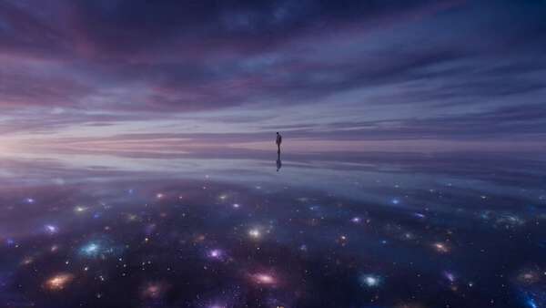
Goal: "Non-Euclidean Aerial" Photography.
   The Setting:  High altitude, suspended in the sky.
   The Background:  A thick, fluffy bed of   Cumulus Clouds   sits just below the central object. Through gaps in the clouds, a faint, hazy aerial view of the "normal" flat city is visible miles below.
   The Sky:  A soft, clear sky transitioning with warm, golden-hour light.

3. Geometry  
   The Structure:  The entire city is constructed on the surface of a massive, continuous, intertwining   Trefoil Knot   (a complex 3D ribbon that loops over and under itself).
   The Gravity:  Gravity is strictly local to the surface of the ribbon. 
       Effect:  Buildings grow  perpendicular  to the surface. As the ribbon twists, buildings point outwards in all 360 degrees—straight up, sideways, and completely upside-down at the bottom of the loops.
   The Artery:  The "Flow" (Step 1) runs continuously down the absolute center of the ribbon, winding through the entire knot, completely defying physics (e.g., a river flowing upside down).

4. Narrative   
   The Integration:  The "Fabric" (Step 1) densely packs every inch of the ribbon. There is no empty ground, only tightly clustered city blocks curving with the geometry.
   The Highlight:  The "Anchor" landmark (Step 1) is prominently placed on one of the outer, upward-facing curves of the knot, jutting out dramatically to break the silhouette.
   Scale:  Include tiny, realistic details: cars driving on the twisting roads, boats navigating the curving river, and green trees lining the avenues.

5. Lighting & Atmosphere:  
   Lighting:    Cinematic Golden Hour.   Low-angle, directional sunlight striking the knot from the side. 
   Shadows:  This lighting is   CRITICAL   to create deep, dramatic shadows where the loops of the knot overlap, emphasizing the extreme 3D depth and complexity of the structure.
   Aesthetic:  Photorealistic Drone Photography, "Inception" meets M.C. Escher.

Output:   ONE image, 1:1 Aspect Ratio, 3D Architectural Render, "Surreal Realism" aesthetic, Hyper-Detailed.
</instruction>

Do this for Paris:

  1. Inference Engine Input A is a Major Global City (e.g., Paris, New York, Venice, Tokyo, Dubai). Deconstruct the city to generate 3 Cartographic Assets : The Anchor (The Landmark): Identify the single most iconic, recognizable vertical structure. (e.g., Paris -> The Eiffel Tower. NYC -> The Empire State Building. Dubai -> Burj Khalifa). The Fabric (The Architecture): Identify the dominant building style, roof types, and color palette of the dense urban areas. (e.g., Paris -> Beige Haussmann blocks with grey slate roofs. Venice -> Terracotta and peeling stucco. Tokyo -> Dense glass, concrete, and neon). The Artery (The Flow): Identify the primary channel cutting through the city. (e.g., Paris/London -> A wide, murky green River. LA -> A multi-lane concrete Highway. Venice -> A Canal).

  2. Container Goal: “Non-Euclidean Aerial” Photography. The Setting: High altitude, suspended in the sky. The Background: A thick, fluffy bed of Cumulus Clouds sits just below the central object. Through gaps in the clouds, a faint, hazy aerial view of the “normal” flat city is visible miles below. The Sky: A soft, clear sky transitioning with warm, golden-hour light.

  3. Geometry
    The Structure: The entire city is constructed on the surface of a massive, continuous, intertwining Trefoil Knot (a complex 3D ribbon that loops over and under itself). The Gravity: Gravity is strictly local to the surface of the ribbon. Effect: Buildings grow perpendicular to the surface. As the ribbon twists, buildings point outwards in all 360 degrees—straight up, sideways, and completely upside-down at the bottom of the loops. The Artery: The “Flow” (Step 1) runs continuously down the absolute center of the ribbon, winding through the entire knot, completely defying physics (e.g., a river flowing upside down).

  4. Narrative
    The Integration: The “Fabric” (Step 1) densely packs every inch of the ribbon. There is no empty ground, only tightly clustered city blocks curving with the geometry. The Highlight: The “Anchor” landmark (Step 1) is prominently placed on one of the outer, upward-facing curves of the knot, jutting out dramatically to break the silhouette. Scale: Include tiny, realistic details: cars driving on the twisting roads, boats navigating the curving river, and green trees lining the avenues.

  5. Lighting & Atmosphere:
    Lighting: Cinematic Golden Hour. Low-angle, directional sunlight striking the knot from the side. Shadows: This lighting is CRITICAL to create deep, dramatic shadows where the loops of the knot overlap, emphasizing the extreme 3D depth and complexity of the structure. Aesthetic: Photorealistic Drone Photography, “Inception” meets M.C. Escher.

Output: ONE image, 1:1 Aspect Ratio, 3D Architectural Render, “Surreal Realism” aesthetic, Hyper-Detailed.